December 2023
By Kristen Zumdahl
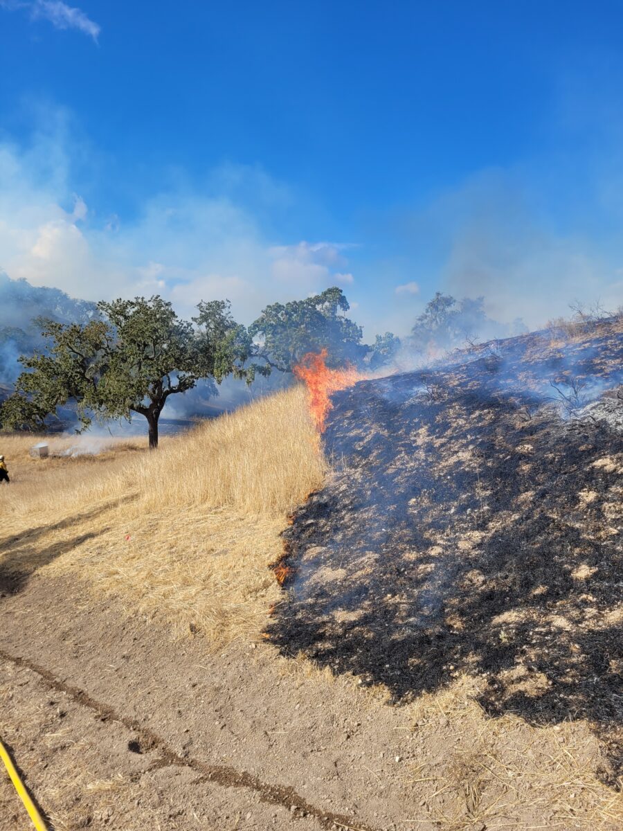
Figure 1. The prescribed burn moves slowly down the slope burning mostly non-native annual grasses in the southwest corner of Sedgwick Reserve.
TREX Summary
Sedgwick Reserve – with collaboration and support from The Nature Conservancy and many other collaborators (listed below) – hosted its second annual Prescribed Burning Training Exchange (TREX). The overarching goals of the prescribed burn were to reduce wildfire risk near neighboring properties, facilitate fire research, steward the land and educate the community about the use of “good fire.”. The week-long TREX provided a wonderful hands-on training opportunity for participants to learn fire management and preparedness and achieve community objectives.
The prescribed burn occurred in the southwest corner of the Reserve and burned about 20 acres of oak woodland, annual grasslands, California sagebrush (Artemisia californica), and purple sage (Salvia leucophylla).
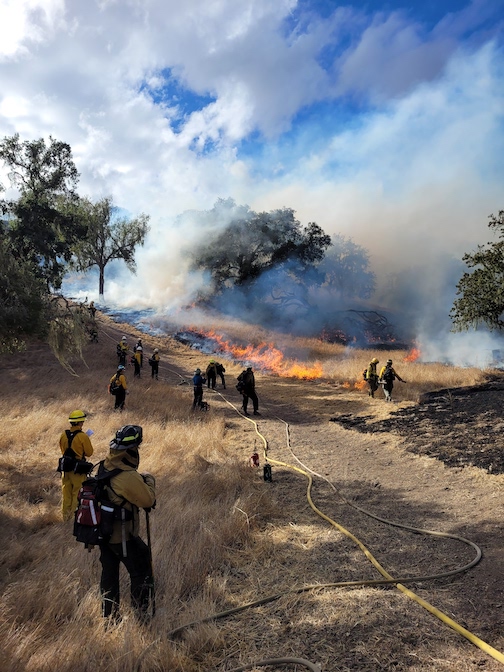
Figure 2. TREX firefighters carefully move the fire to the end of the fuel break to finish the burn. The fuel break is created to stop the fire. Photo credit: Anonymous TREX participant
TREX participants arrived at Sedgwick Reserve from all over California, the US, Canada and Spain. Involvement included the Santa Barbara County Fire Department, Santa Barbara Fire Safe Council, The Nature Conservancy’s Jack and Laura Dangermond Preserve, the University of California Natural Reserve System, the University of California Agriculture and Natural Resources (ANR), California Polytechnic State University (Cal Poly), NASA’s FireSense program, researchers, land managers and other partners interested in learning about prescribed fire and fire management. Sedgwick Reserve’s Director of Operations, Lyza Johnsen, participated in the TREX as part of her Prescribed Fire Burn Boss training!
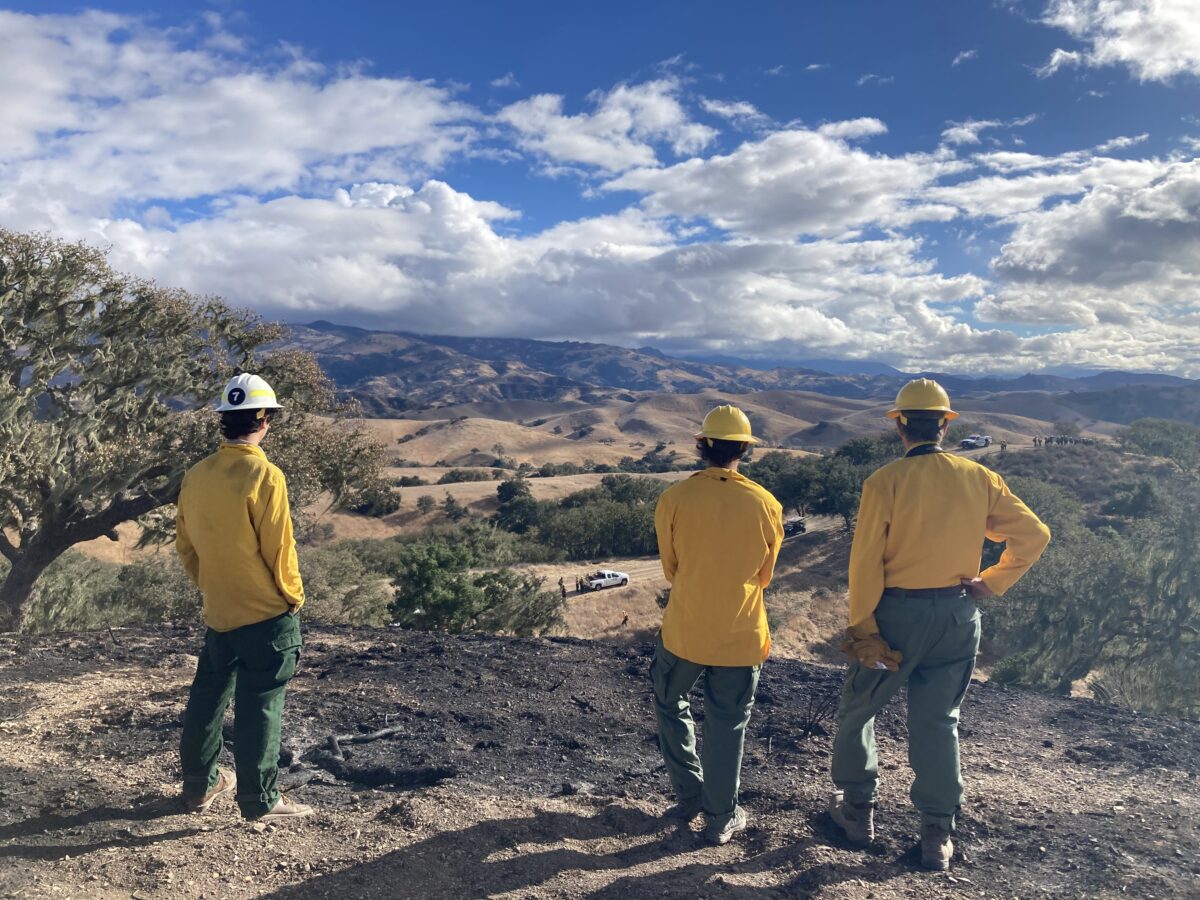
Figure 3. Researchers looking on as the burn enters their fire research plots.
Prescribed fire can be an effective tool for protecting human and natural communities through managing fuel loads while at the same time promoting native diversity in our local ecosystems. It also provides opportunities for researchers to study fire behavior as well as the pre- and post-burn effects of fire. As foothill wildfires are becoming increasingly frequent, this research can be used to guide land management practices and increase awareness and safety amongst agencies and the public. Research during the 2023 TREX was supported in part by a grant to UCSB from the Gordon and Betty Moore Foundation, as well as by a CalFire grant to UCSB Ph.D. candidate Kaili Brande and by NASA’s FireSense Program.
Prescribed burning sparks NASA’s interest
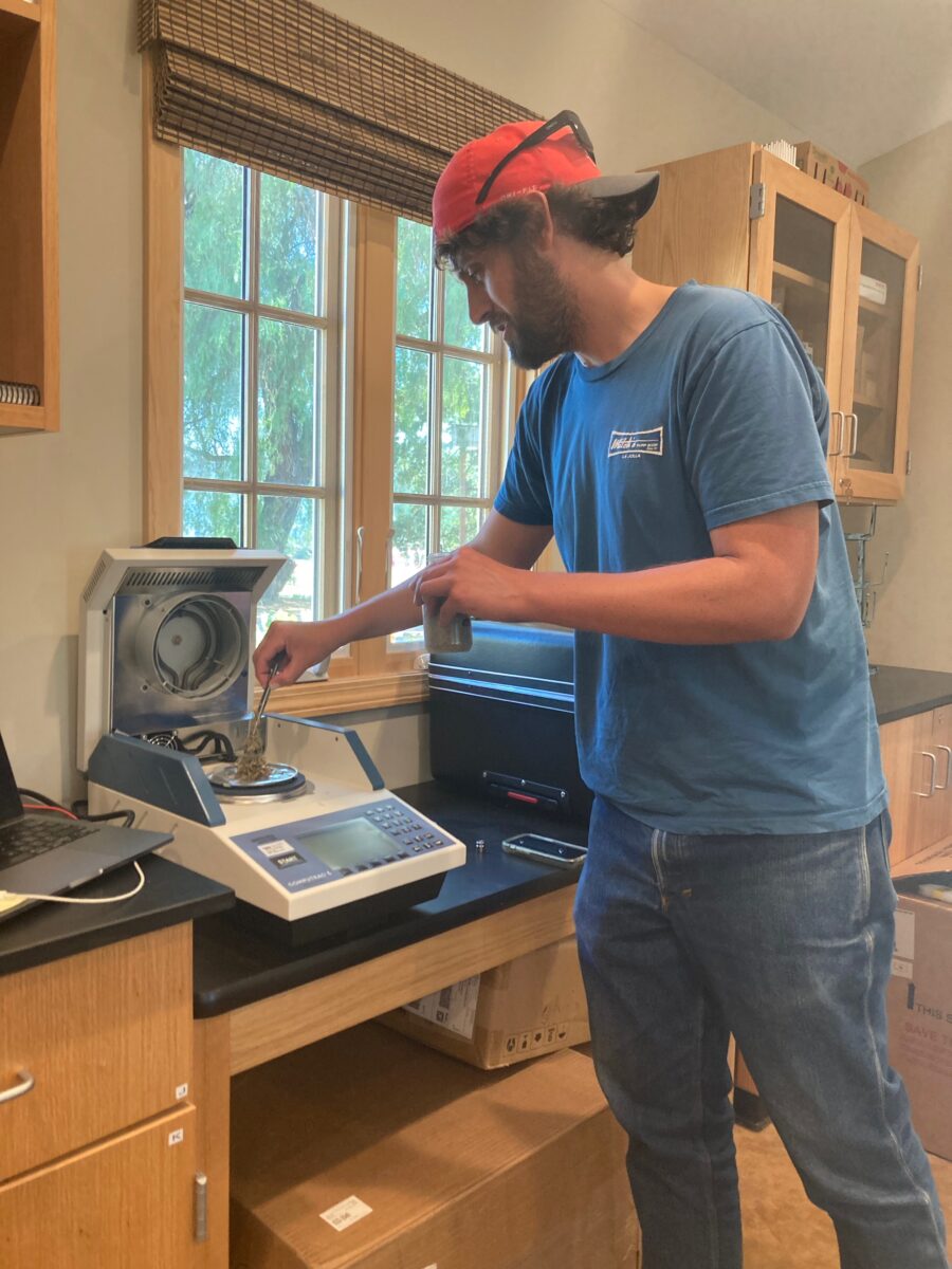
Figure 4. Prof. Dan Sousa from San Diego State University is measuring live fuel moisture of purple sage using a live fuel moisture analyzer machine.
NASA’s FireSense program will implement new airborne imagery technologies for studying and reducing the impact of wildfire. The project’s goals will focus on four main characterizations and measurements of the landscape including; pre-burn fuel conditions, tracking active fire, post-fire effects and air quality and smoke forecasting.
Professor Dan Sousa from San Diego State University is conducting research in support of NASA Airborne Science through the FireSense program which includes uncrewed aerial system (UAS) Structure from Motion (SfM) photogrammetry, LIDAR, and multispectral imaging, as well as ground-based biophysical measurements of soil and plant water content. This is a five year program that includes flights from several airborne sensors. One of these is AVIRIS-3, (the third generation of the Airborne Visible/Infrared Imaging Spectrometer). Traditional cameras measure just three colors (red, green, and blue), each corresponding to a broad range of wavelengths of light. But imaging spectrometers like AVIRIS-3 measure hundreds of precise, narrowly spaced wavelength ranges, including at infrared and ultraviolet light. This more precise information is used to identify, measure and monitor landscapes (learn more about AVIRIS here).
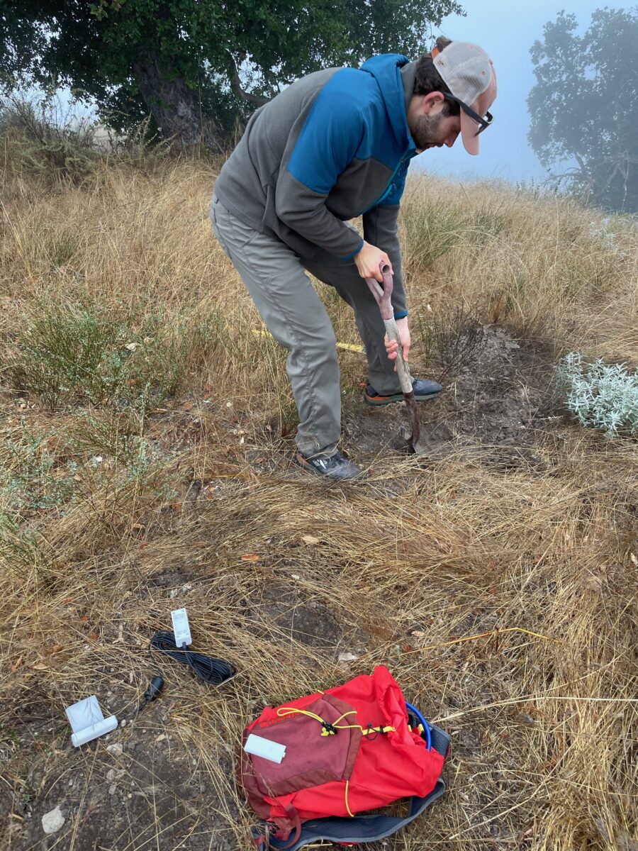
Figure 5. San Diego State University Master’s student Bruce Markman digs into Segdwick’s soil to measure soil moisture at different depths.
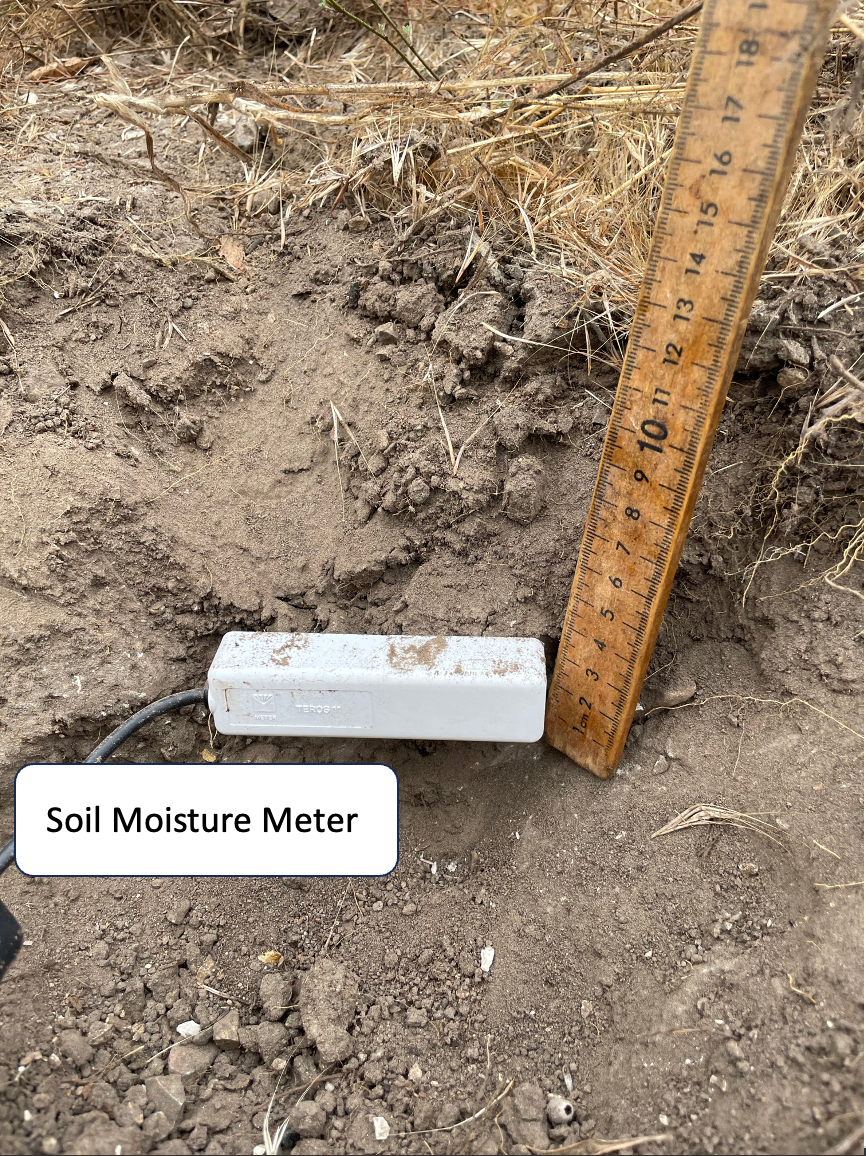
Figure 6. After digging, the soil moisture probe is inserted and measures soil moisture and temperature at different depths.
In September 2023, Professor Dan Sousa led a pre-burn ground truthing team that worked in conjunction with the NASA flights to measure soil moisture and soil temperature, as well as live fuel moisture in four common plant species around Sedgwick Reserve (Coast live oak (Quercus agrifolia), blue oak (Quercus douglasii), purple sage, and California sagebrush). These ground data will be used to compare against data from NASA’s airborne sensors, including AVIRIS as well as the Scanning L-band Active Passive (SLAP), and UAV Synthetic Aperture Radar (UAVSAR) instruments. The hope is to use these instruments over large landscapes in areas inaccessible to humans to improve our understanding of fire-prone California landscapes, and ultimately advance land management and fire spread modeling. Airborne campaigns like these can be used as testbeds by NASA to help optimize sensors to eventually be launched into space, helping scientists understand how these landscapes change over much larger areas and much longer times.
During the TREX 2023 burn, NASA planes returned to Sedgwick Reserve to capture imagery of fire as it was happening. Future planned flights will take place over the next four years of this program across the western United States.

Figure 7. Sousa’s team collects soil moistures and temperatures as the AVIRIS plane (circled) makes passes across Sedgwick’s burn units. Photo credit: Prof. Dan Sousa, San Diego State University